
8 Spring Hikes in Salt Lake City, Ogden & Park City

Many trails are still buried under several feet of The Greatest Snow On Earth. So where can you hike during early spring near the greater Salt Lake area? Here are a few suggestions.
Now why don’t I include Southern Utah? Because It’s ALL good down there right now. Want some ideas? Here is a post I wrote about that area: 6 Dramatic Hiking Trails near Brian Head and Eagle Point
I’ve written about several of these trails in the past, so look for links to those posts in the descriptions.
8 Spring Hikes Near Salt Lake City, Ogden, and Park City
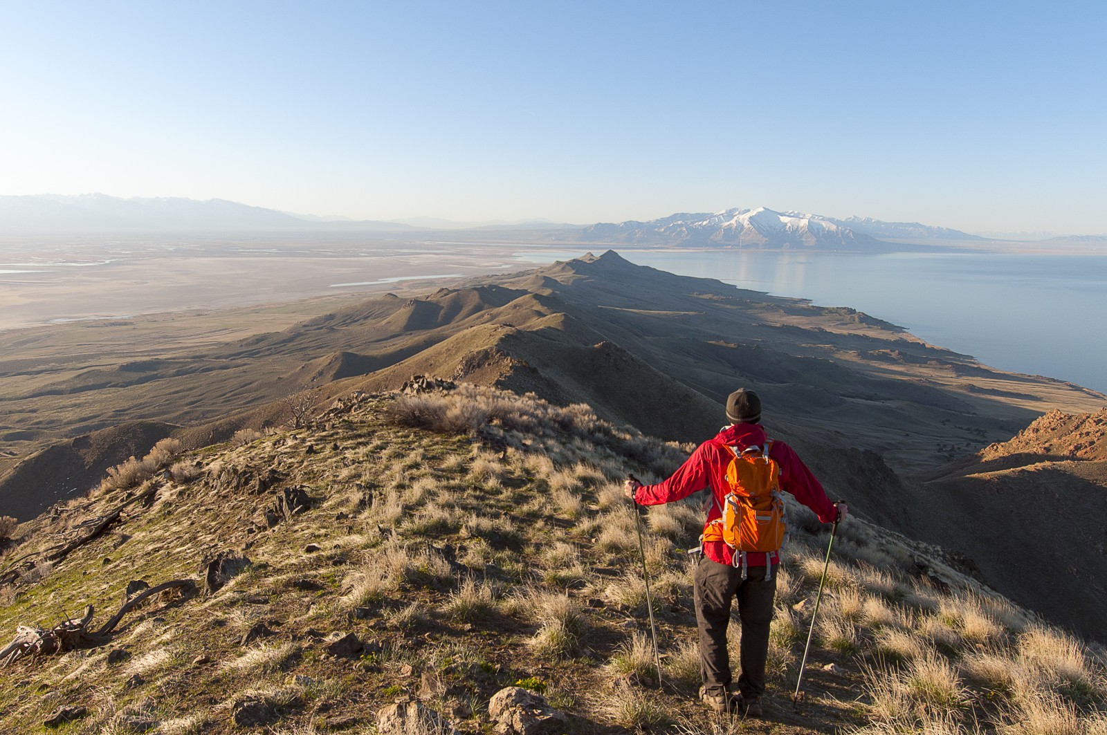
Antelope Island State Park, Davis County
Antelope Island is located in the Great Salt Lake with 28,022 acres packed with beautiful views, trails and wildlife. In addition to hiking trails there are beach areas, campgrounds and a marina. And yes, there are antelope, plus some bison! The link above lists 10 of the trails in the park.
For high views, hike the Frary Peak Trail to the highest point on the island. Rumor has it you can’t take a bad photo from the summit.
Distance: 6.2 Miles RT
More beta: Pack sunscreen, bug repellant and plenty of water. There is an optional scramble past the third mile on the Frary Peak Hike to the summit.
Emigration Canyon Ridgeline, Salt Lake City
This trail is so well used it’s typically accessible year-round. You might want to wear microspikes during winter, but any snow should be packed barring a recent dump. Otherwise, it is exposed and perfect for spring hikes or trail runs. Located on a ridge, the views are stunning!
A parking area is located at the ridgeline where the trail crosses the highway. Park here and hike out and back in either direction.
Distance: Up to 9.3 Miles RT
Mount Van Cott, Salt Lake City

I love this hike because of the views at the summit and how the terrain slopes just right to lie down for a brief nap (with scenery). It is one of the less used trails near the city and therefore allows for some quiet and meditative moments. The trail winds uphill, steeply, from the Jewish Community Center just minutes from downtown. The final half-mile or so crosses a pretty meadow before rising to the summit.
Distance: 3.4 Miles RT.
Trailhead: Take 100 northeast to the University Hospital. Look for the Jewish Community Center on the left and turn in. The substation is behind and a little to the right and has several parking spaces for hikers/bikers.
More beta: This trail is very open and exposed to the elements, which means it can be hot in the summer and could cool off quickly during other seasons. Pack plenty of water and layers in addition to your regular hiking basics.
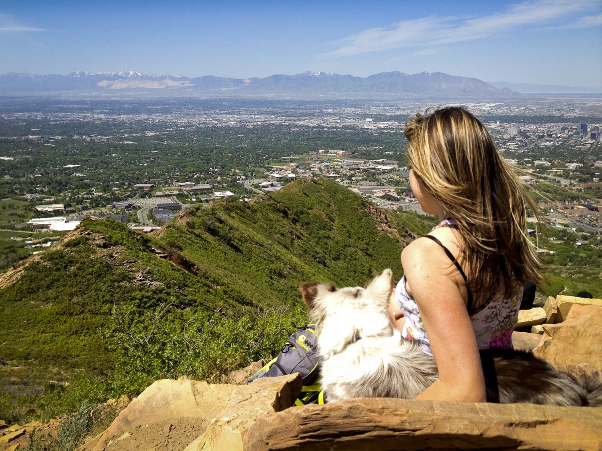
Mount Wire (AKA Big Beacon), Salt Lake City
Such a nice hike, I’ve done it over and over. Sunsets here are spectacular and unobstructed. There is an abandoned tower at the top (it is unmaintained, so climb it at your own risk.) The hike meanders up a canyon and around the mountain providing variety and views the whole way. The summit is totally cleared so a cool breeze blows cools it most of the year, pack a puffy!
Distance: 4.1 Miles
Trailhead: Located on the east side of the University of Utah on Colorow Road near the Historical Museum. Park along the road.
More beta: I’d call this a moderate hike because the distance is short. Sections of the hike are a little steep. The elevation gain is a total of 1,919 over half the distance (according to our GPS) so that will likely wear you out.
The Living Room, Salt Lake City
This trail is a Salt Lake City classic. The link above is a winter 360 shot of the view…stellar! There are multiple routes to get there, including the one I mention in my post about Mount Wire. Alternatively, you can hike a less strenuous route leading up a wash from the Bonneville Shoreline train toward Mount Wire, but then fork off to the left toward the Living Room. There is also a route from the Red Butte side. I’ve hiked all three and find the Mount Wire route the easiest and the “direct up the ridge” route the most fun.
Distance: Roughly 2.8 miles round-trip with 1,100 feet of elevation gain, depending on which route you choose.
Trailhead: Located on the east side of the University of Utah on Colorow Road near the Historical Museum. Park along the road.
More beta: Here is a link to a map showing the easiest, most common, route: EveryTrail Map pack a dinner and stay for sunset.
Twin Peaks and Little Black Mountain, Salt Lake City
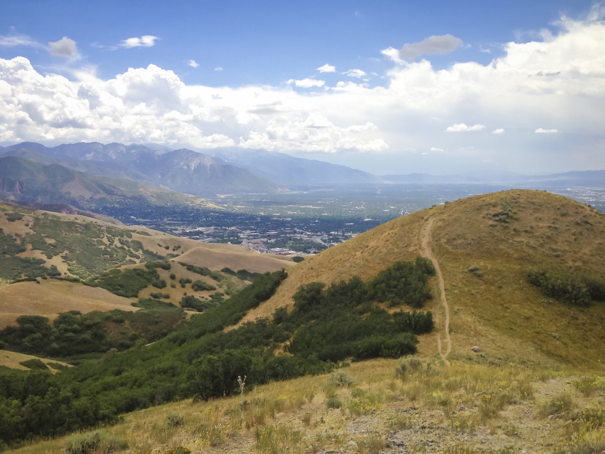
For a view from a different angle, I head to Twin Peaks in the Avenues. The trail is open and exposed to the sun making it perfect in the spring and fall. I hiked it in the summer and found it a bit uncomfortable. I’ve also hiked it at night by moonlight, perfection! The trailhead is deep in a neighborhood.
For an even better view and leg-burning workout, continue on to the summit of Little Black Mountain by hanging a left at a fork 1.6 miles from the trailhead where the trail to Twin Peaks splits off to the right. More information on this option can be found HERE. Just remember to pack food and hydration for this longer hike. I hiked this trail with my pup without realizing how much more strenuous it was than Twin Peaks. I ended up giving the dog the last of my water at the peak (I tend to look after my fur babies first). Poor planning on my part.
Distance: 3.8 Miles RT
Here are directions from A Girl on a Trail:
Trailhead: In SLC, head north on 7th Ave. Take a slight left, then right and continue on I St. in the Avenues. Turn right on 13th Ave, then veer left onto Northcrest Drive. Turn left on Terrace Hills drive, and park at the end of the street, in the cul-de-sac.
Round Valley Trail System, Park City
Park City’s Round Valley area sits at 6,500’ making it your best bet for spring hiking. It’s located just north of Old Town and offers 30 miles of hiking and biking trails perfect for all skill levels. Added bonus...this trail system is dog-friendly! Do keep them leashed to avoid a K-9-bicycle collision. A handy interactive map is available on MountainTrails.org.
During the winter, it’s a destination for Nordic skiing, snowshoeing, and fat bike riding.
Waterfall Canyon Trail, Ogden
A short moderate hike featuring views and a waterfall at the end…what’s not to love!? It is a bit rocky, so wear sturdy shoes. Like many waterfall trails, there’s some elevation gain to endure, but its short length means you can take your time if you’re not accustomed to the altitude.Distance: 2.5 Miles RT
Trailhead: Follow the link above for directions.
More beta: Dogs are welcome and don’t forget your camera!
Check out these posts for more hiking and biking inspiration:
- Ogden’s Top Trails
- Salt Lake’s Top Hiking Trails
- Park City’s Top Trails
- From Slopes to Trails: Spring Hiking and Biking in Utah
- What You Need to Know About Hiking With Dogs in Utah
- 5 Spectacular Fall Hikes Near Salt Lake City
Have fun and I’ll see you on the trails!
comments
Partners In Promoting Utah Powder


1 Comment
Kristi \ 7.3 years ago
I'm heading to Utah to do a trail race on Antelope Island on March 18. I fly into SLC on March 12 and fly out the morning of March 24, so I have about 5 days either side of the race to explore. On those days I want to hike. In mid March would you recommend going south both before and after the race to hike (thinking Canyonlands, Zion, Bryce) or are the trails in good shape at that time of year to get in some good hikes in SLC area?
Erika \ 7.3 years ago
Hi Kristi, that time of year you'll likely have to stick to lower hikes around SLC unless you rent some snowshoes (which could be fun:). If you have time, I'd head south to check out the hikes down there. They are completely different and you won't regret the drive. Then on the other end of the race hike the lower trails near SLC, or go for a snowy adventure. Good luck on your race and let me know what you end up hiking! Erika