
Utah Snowpack Off to Best Start in Almost 20 Years

words by Evan Thayer
As is so often the case, winter arrives in an instant here in Utah. We experienced record warmth in September and a dry and mild first three weeks of October. However, Mother Nature was just lulling us to sleep before she brought in Old Man Winter to shake us from our slumber and tell us to strap on our ski and snowboard boots.
Since the cold weather arrived, we have seen two distinct storm cycles here in Utah. The first was from October 23–27 and featured two storms dropping up to 30” of snow in the Wasatch Range of northern Utah, including the Cottonwood Canyons. After a brief break to close out October and start November, a second, more substantial, cycle rocked Utah with three consecutive storm systems bringing up to 65” of snow.
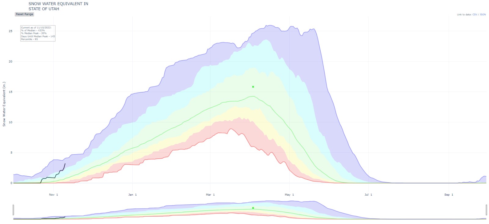
While the snow totals are impressive, what is even more impressive is the water content contained in this snow. Utah’s snowpack as the storms wrapped up last week was sitting at 433% of normal as a statewide average:
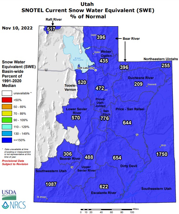
Every snowpack basin in the state is reporting numbers way above the median for the date:
If we dive into the data of a single site, we can see the numbers are even more impressive. Snowbird's Snotel station, which has tracked seasonal snowfall data going back to 1990, is currently reading 11” of snow-water-equivalent:
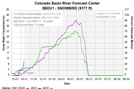
Only one other year has seen this healthy of a snowpack this early in the season (2004). To put this into context, our snowpack in Little Cottonwood Canyon (home to Alta Ski Area and Snowbird) is currently at the level we would expect on January 1. So, we are more than a month and a half ahead of the typical median snowpack!
While Snowbird’s snotel is just one example, the same story is true at most locations throughout the state. We are, across the board, running weeks ahead of the typical median snowpack levels.
What does this mean for our ski and snowboard season going forward? I wish I could say that a good start to the season correlates to above-average snowfall for the rest of the season, but that is not necessarily the case. However, we have a significant buffer right now that gives us a leg up on most years, dramatically decreasing our chances of having a below-average year. In a more practical sense, this early season snow all but guarantees that Utah resorts will have most, if not all, of their terrain opening as we head into the holiday season.
Already, we have seen a number of resorts open or push up their opening dates thanks to this early snow. You can find a full list of opening dates here. Cold temperatures behind these storms are also allowing resorts to make snow to supplement the natural snow. Personally, this is the best start I’ve seen since living in Utah (15 years) and I’m optimistic there will be many more powder days ahead!
For the latest forecast throughout the season, please check opensnow.com.
Partners In Promoting Utah Powder


comments
Leave Your Comment