I enjoy spectacular views, peaceful trails, and feeling a sense of accomplishment, so when I pick a trail to hike, it’s often a challenging route. Previously, I’ve written about easy hikes, however, I realized there are other people, like me, who prefer a challenge! If you’re in that camp, this list is for you.
I opted to skip some challenging classics such as Mount Timpanogos and Angel’s Landing in favor of slightly less-traveled trails.
As you plan your hike, keep a few things in mind:
- These are challenging hikes, so make sure you let someone know your itinerary before heading out.
- Due to high elevation, temperatures can vary wildly. Pack layers to keep you comfortable in both sun (consider a sun hoodie) and cold as the sun sets.
- Some of these trails may have snow cover into June or later. Check conditions before you go.
- Carry essential supplies in your daypack. Not sure what that should include? Read this post I wrote Staying Safe with the Ten Essentials of Hiking
- Not all trails allow dogs, so check before inviting your fur baby.
- Be courteous. This post explains the basics from wildlife to right of way, Good Mountain Manners
This list includes hikes from Southern Utah to Ogden, so there will be an option wherever you plan to base your stay.
Northern Utah – Ogden Region
Malan's Peak Trail
Highlights: Great views, wildflowers, not crowded, dog friendly
Length: 4.4 miles
Elevation Gain: 2,100 ft
Type: Out and back
Dogs: Yes, on leash
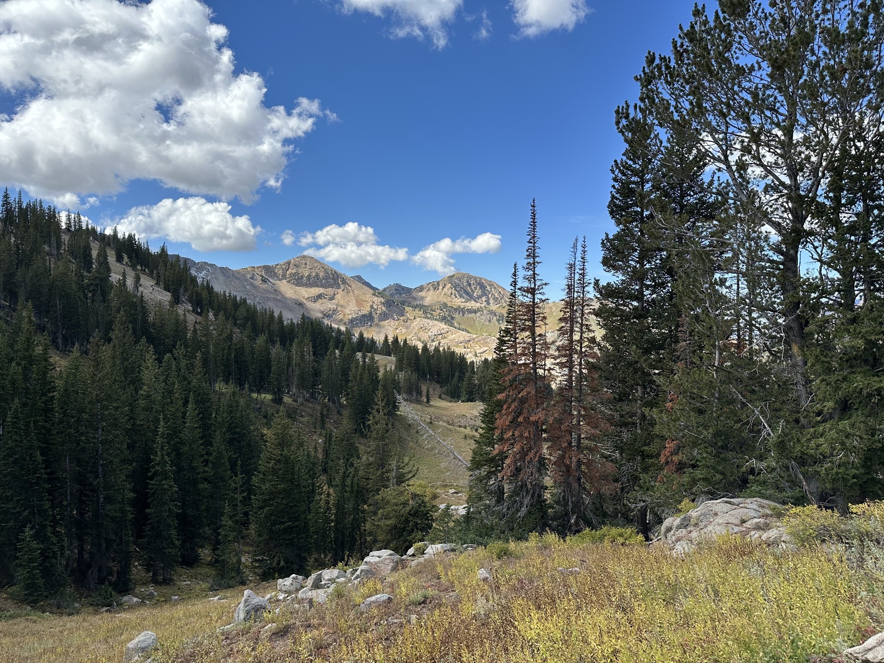
Ben Lomond Peak via North Skyline Trail
Highlights: Amazing views, dog friendly, great fall color.
Length: 15.7 miles
Elevation Gain: 3,540 ft
Type: Out and back
Dogs: Yes
Tips: Start early and pack lots of water. Holds snow well into spring, check conditions. Hike as much or as little as you like, there are pretty views either way. Mountain bikes share the trail during the summer.
Northern Utah – Salt Lake and Park City Region
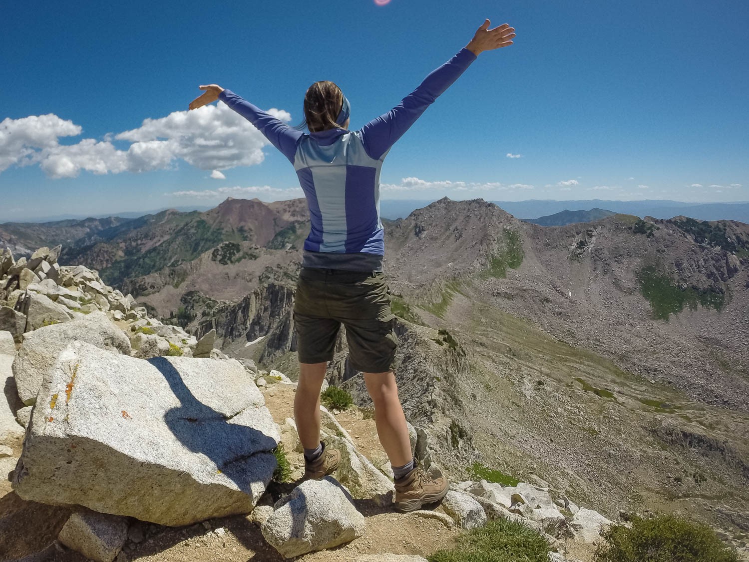
Pfeifferhorn via Red Pine Lake Trail
Highlights: Alpine peak views, lakes, scramble at the top, flowers
Length: 9.9 miles
Elevation Gain: 3,664 feet
Type: Out and back
Dogs: No
Tips: This trail is an absolute challenge, but totally worth the effort. Be sure to check trail conditions and weather due to its high elevation – 11,326 ft. Pack sunscreen as there’s little shade towards the top.
Sunset Peak via Catherine Pass Trailhead
Highlights: Alpine peak views, relatively short distance, lake views, wildflowers, wildlife, not crowded
Length: 4.0 miles
Elevation Gain: 1,322 feet
Type: Out and back
Dogs: No
Tips: There is a fee to enter this area ($12 at time of writing), parking can fill up midday because there are many trails in the area, wildflowers peak late July (stunning!), elevation of the peak is 10,648 feet ~ check conditions before heading out
Provo Region
Emerald Lake via Mount Timpanogos Trail
Highlights: Wildlife, wildflowers, views, lake, dog-friendly
Length: 10.3 miles
Elevation Gain: 3,467 feet
Type: Out and back
Dogs: Yes, on leash
Tips: Elevation reaches 10,386 feet ~ check conditions before heading out, fee to park, wear good shoes, wildflowers are lovely in August, water levels will be low in the fall, head out early and be prepared for a tough yet rewarding hike.
Timpanogos Upper Falls
Highlights: Waterfalls, wildflowers, lots of wildlife, stunning views, dog-friendly
Length: 7 miles
Elevation Gain: 2,171 feet
Type: Out and back
Dogs: On-leash
Tips: Can be busy on weekends, fee to park ($10 cash at time of writing), click HERE for parking reservation info, bring plenty of water, wear good shoes, water flow will be low in the fall. The trail is exposed, so consider a hat and pack sunscreen.
Southern Utah
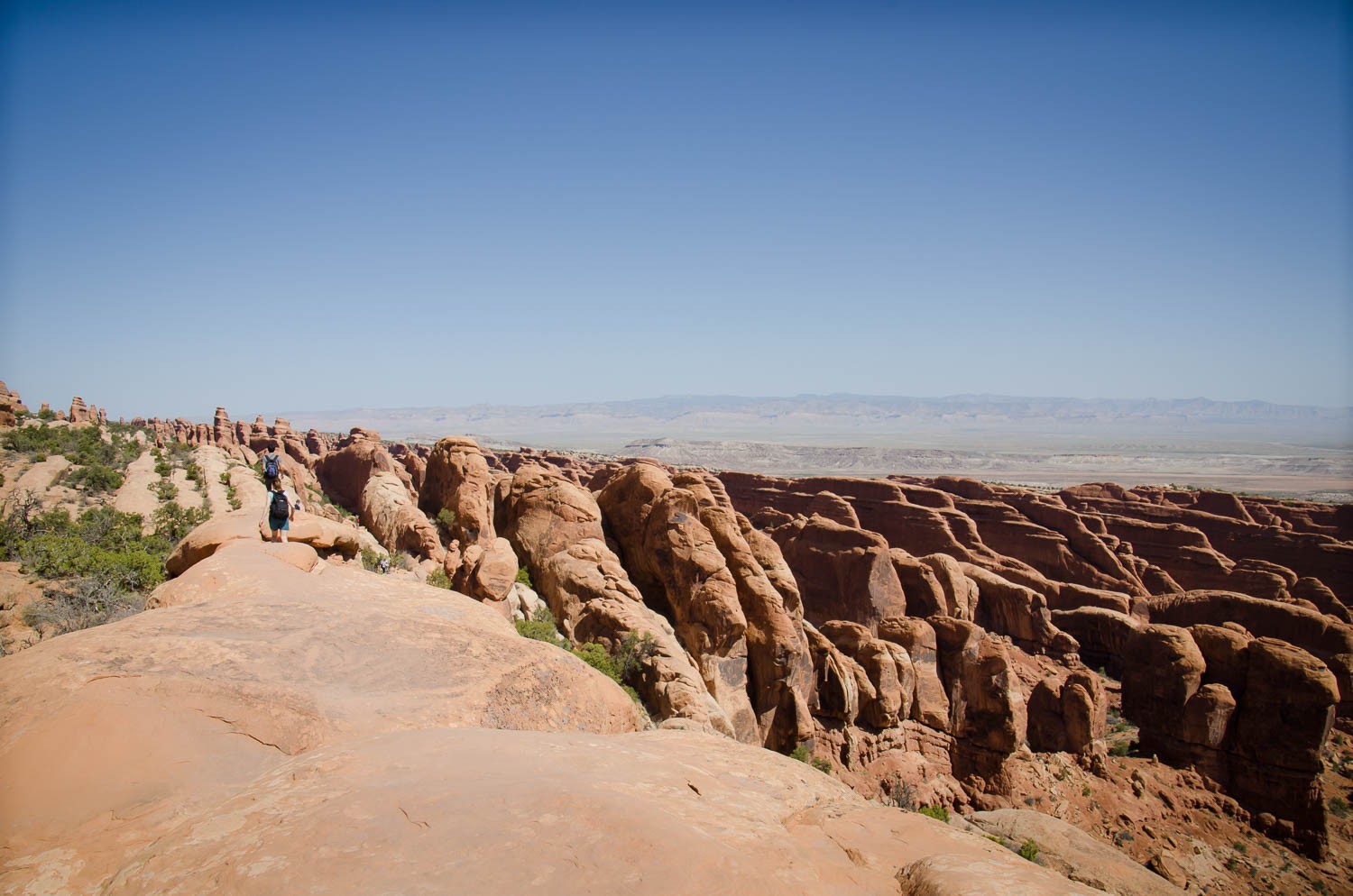
Devil's Garden Trail
Highlights: Multiple arches, not crowded, great views, one of my personal favorites!
Length: 8 miles
Elevation Gain: 1,158 feet
Type: Loop
Dogs: No
Tips: Inside Arches National Park. In an otherwise busy park, the crowds dissipate as you begin the “primitive trail”. Wear shoes with good traction; pack layers, plenty of water, and sunscreen. There are side paths to arches worth taking the time to visit, especially Private Arch.
Cassidy Arch via Frying Pan Trail
Highlights: STUNNING views, not crowded, red-rock landscapes, accessible arch you can walk across.
Length: 8.3 miles
Elevation Gain: 2,391 feet
Type: Out and back
Dogs: No
Tips: Inside Capital Reef National Park, for a shorter hike, consider the Cassidy Arch Trail, pack more water than you think you’ll need, wear good shoes, carry layers for sun and cold, and download or carry a map. Be ready to take lots of pictures!