words by Evan Thayer
After a cold and snowy October, the weather pattern in the western United States was dominated by a high-pressure ridge during the month of November. This ridge limited the amount of cold air and snowfall we received in Utah. For snow lovers, our less-than-stellar November was a disappointment after the season’s auspicious start in October. However, I am happy to report the weather pattern is changing and Utah will see potentially significant snowfall return this week.
The period of heaviest snowfall will be Wednesday night through Friday as a cold storm system drops into Utah out of the northwest. Temperatures will plummet Thursday and Friday with snow falling all the way to valley floors.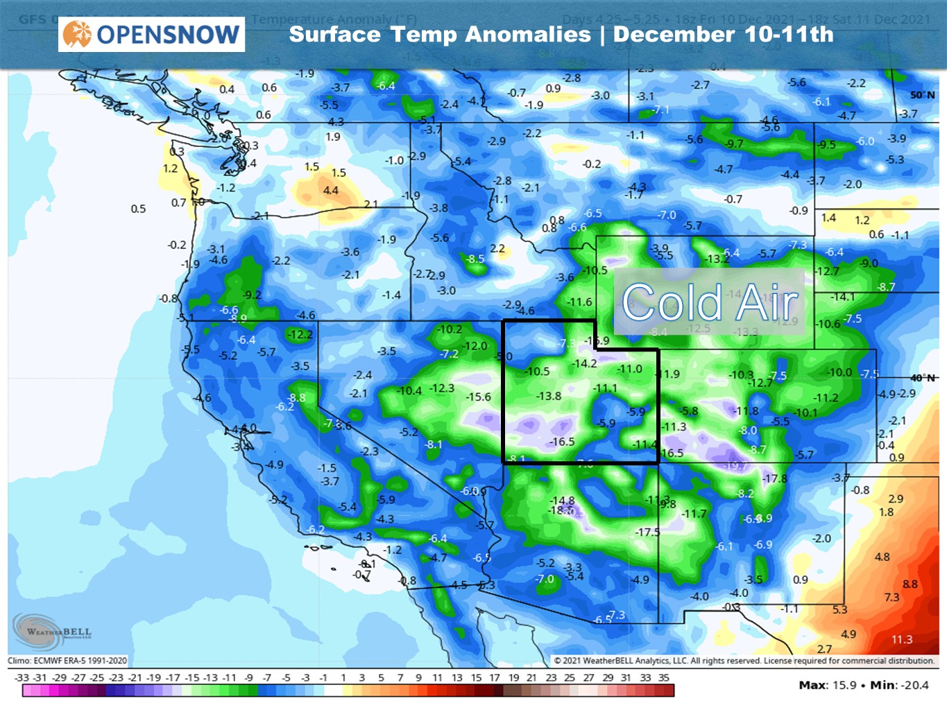
This system will also tap into plenty of moisture off the Pacific Ocean. Forecasting models have consistently shown that most high elevation locations of Utah could see significant snowfall accumulation with a foot or more likely by Friday.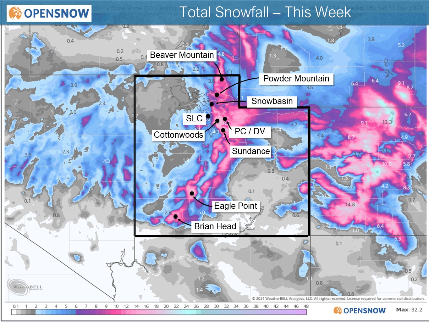
During and after the storm, resorts with the ability to make snow will be able to do so around-the-clock thanks to the cold temperatures – supplementing the natural snowfall with man-made snow. While it is too early for details, long-range forecast models currently show the pattern staying active leading up to the Christmas holiday period.
For daily snowfall amounts, please check the Ski Utah Snow Report. For additional forecast information, please check OpenSnow. And, if you feel like learning how to forecast on your own, visit my blog on DIY Forecasting.