words by Melissa Fields
Whether you pedal, roller blade, skate board or simply push a stroller, paved pathways occupy that appealing sweet spot between the smoothness of a roadway and the safety of a sidewalk. Though paved pathways first came about in the 1960s, when municipalities and nonprofits began paving over abandoned railroad tracks, paved paths now span more than 24,000 miles across the United States, including the dozens of paved paths here in Utah. While the following list is not exhaustive, following is a dozen of the state’s best.
Bear Lake Legacy Pathway
The grand vision for this two-lane asphalt trail is 50 miles circumnavigating Bear Lake, a crystalline-blue natural lake in Northern Utah. For now, you can pedal or stroll the Bear Lake Legacy Pathway’s current 4.8-mile length along the lake from the Bear Lake State Park Marina/Harbor Village (with a slight detour around Garden City) to Ideal Beach or vice versa.
Big Cottonwood Trail
This shady paved pathway in Cottonwood Heights runs for about two miles along the Big Cottonwood Creek, from the Park & Ride at the mouth of Big Cottonwood Canyon to Knudson Park in Holladay. Points of interest along the way include interpretive signs about Cottonwood Heights’ history, the abandoned Cottonwood Paper Mill and trailside restaurants.
Canyon 2 Canyon Trail
Southern Utah’s 20-mile, super-scenic Canyon 2 Canyon Trail begins near Bryce Canyon City at the west entrance of Red Canyon. The path’s first six miles wind past red rock formations—known as hoodoos—along Highway 12. The route continues east for another 14 miles, crossing the Paunsaugunt Plateau and then turns south on Highway 63. The pathway continues through Bryce Canyon City connecting to the new Bryce Canyon Shared-Use Path, which ends at Bryce Canyon National Park’s Inspiration Point.
Denver & Rio Grande Western Trail
The Denver and Rio Grande Western Rail Trail extends north from West Bountiful and passes through the Farmington Bay Waterfowl Management Area, where it joins the Legacy Parkway Trail. Continuing north, the trail travels through Farmington, Kaysville, Layton, Clearfield and Clinton to Hinckley Drive on the border of Roy and West Haven.
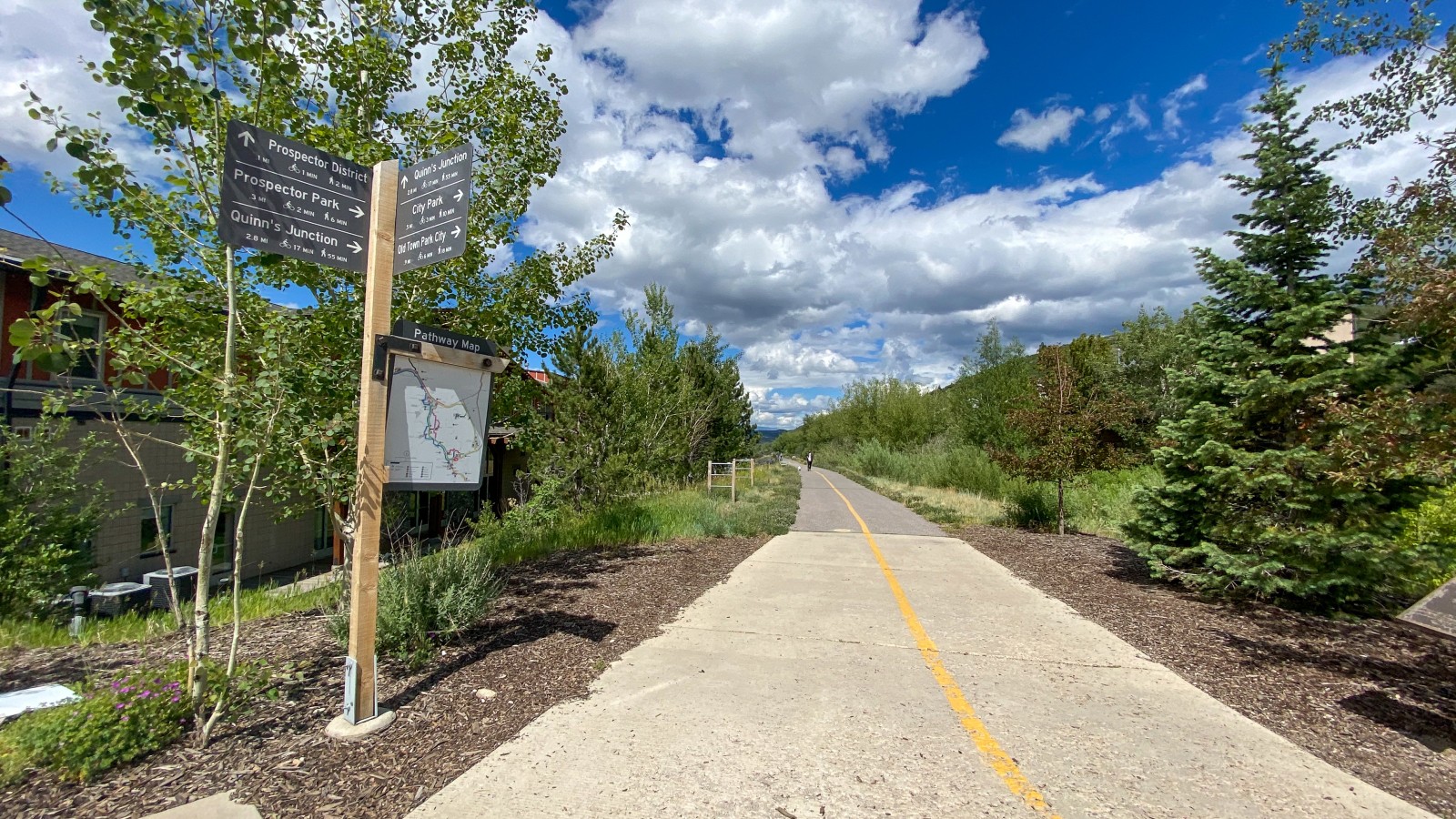
Historic Union Pacific Rail Trail
This 28-mile former railroad route, running from Park City east to Echo Reservoir, has the distinction of being Utah’s first non-motorized rail trail. From Park City, the route is paved for about three miles and then turns to smooth road base. Scenery along the route includes wetland meadows in Silver Creek Canyon, the towns of Wanship and Coalville and the Weber River. Back in Park City, the rail trail connects to miles of other paved paths and dirt singletrack.
Jordan River Parkway
Known as the backbone of Salt Lake County’s paved pathway system, the Jordan River Parkway is a 45-mile long north-south pathway paralleling the Jordan River. The trail further connects to neighboring counties, allowing for travel to Utah Lake to the south and the Great Salt Lake to the north.
Moab Canyon Parkway
This super-smooth blacktop path, located in one of Utah’s most famous towns, Moab, begins at the junction of Highway 191 and Highway 128 at the north end of town. En route, the trail passes over the Colorado River and goes past Courthouse Wash, Arches National Park, the Moab Brands Mountain Bike Area and the Gemini Bridges Road. The south end of the trail connects to other paved trails meandering in and around Moab, to Dead Horse Point State Park and to the Grandstaff hiking trail.
Murdock Canal Trail
The path extends for 17 miles from the Orem City Cemetery all the way to the Adobe building in Lehi. Seven trailheads pepper this well-signed route, most of which have ample parking, picnic areas, drinking fountains and restrooms. If you choose to make your way down the entire path, you will have woven through seven Utah County cities including Orem, Lindon, Pleasant Grove, Highland, Alpine, American Fork and Lehi.
Parley’s Trail
This eight-mile paved walking and biking path links the Jordan River Parkway on the west to the mouth of Parley’s Canyon on the east. This route travels along Interstate 80, through shady residential areas, past numerous stores and restaurants and a huge park in Salt Lake City’s Sugar House neighborhood.
Snow Canyon Loop
This 18-mile paved doubletrack loop in St. George follows Highway 18 north to the top of Snow Canyon (part of a 7,400-acre state park filled with lava flows and soaring sandstone cliffs—it’s even home to the endangered desert tortoise) and then swings back to St George along the Snow Canyon Parkway. For a shorter route, just ride up into Snow Canyon as far as you want, then return the way you came. Note: cyclists, roller bladers and all other wheeled visitors will be charged a fee per person upon entering Snow Canyon State Park, $10 for Utah residents, $15 for non-residents.
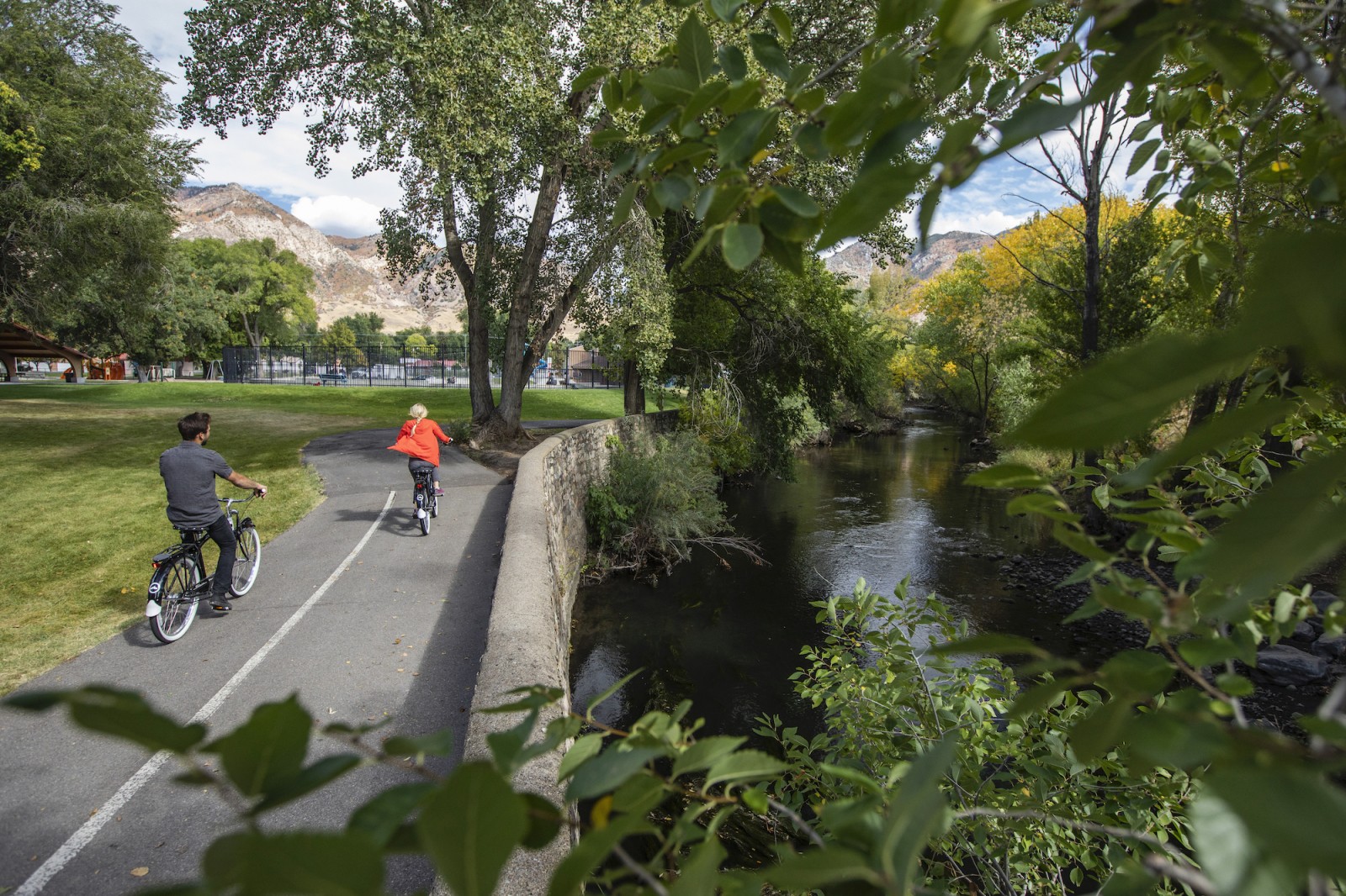
Ogden River Parkway
This spectacular 9.6 miles out-and-back paved path begins at the mouth of Ogden Canyon and follows the Weber River past kayak parks, fishing holes, a botanical garden, multiple parks (including a dinosaur park) and several restaurants and shops. This trail is suitable for all ability levels, is accessible year-round and links into many other trails in the area. Dogs are also able to use this trail but must be kept on leash.
Provo River Parkway
This 15-mile paved pathway weaves its way through Utah Valley’s many parks, as well as residential and commercial areas, following the Provo River from Utah State Lake Park, along Provo’s University Avenue, to Vivian Park at the mouth of Provo Canyon. At its northern end, the trail passes the base of Bridal Veil Falls for a spectacular view.