words by Evan Thayer
The Law of Averages suggests that for every epic, off-the-charts, record-breaking snow season in Utah, there has to be a below-average season to maintain the balance. Three years ago, we redefined what is possible in a snow season with up to 903” of snow in Utah. Our statewide snowpack that season was officially deeper than we have ever seen in recorded history.
We were able to follow up that record season with another solidly above-average season in 2023–24. Then, last season, we regressed simply back to what amounted to an average season, which still meant well over 500” of snow for Utah’s snowiest ski areas.
This meant that entering this winter, we were probably overdue to finally see a below-average season. Sure enough, the Law of Averages caught up with us. While we still have up to two months left in our ski season, we are unlikely to catch up on our average snowpack, statistically speaking. As of the beginning of March 2026, the statewide average snowpack sits at 62% of normal.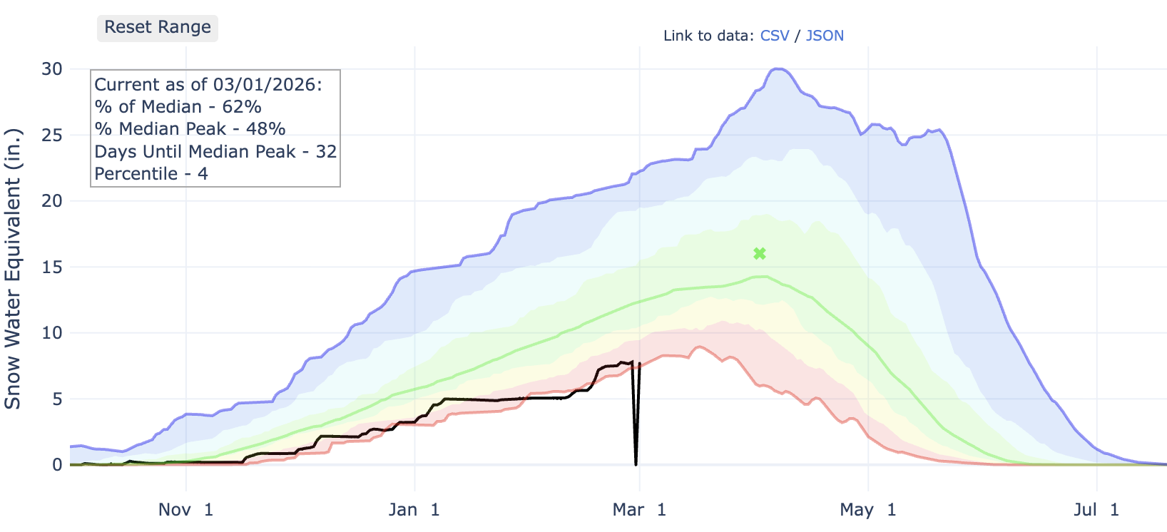
However, if we look deeper into the numbers, we actually find that the snowpack at higher elevations – elevations at which the majority of skiing actually occurs — isn’t nearly as dire. For example, Snowbird’s SNOTEL site currently sits at 82% of the median for the date.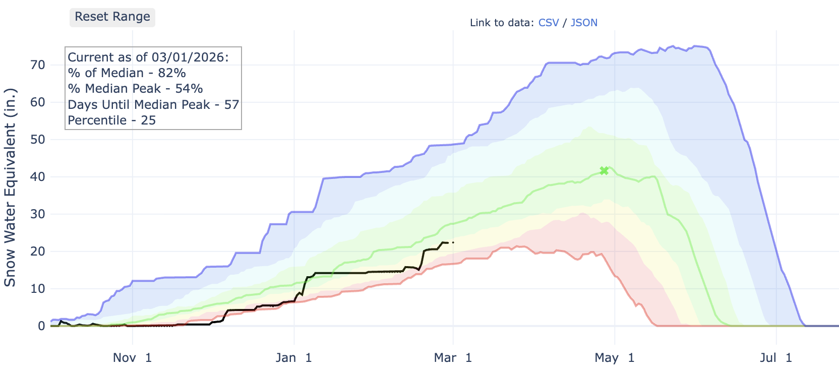
In far northern Utah, Tony Grove Lake (near Beaver Mountain) is faring even better at 88% of the median.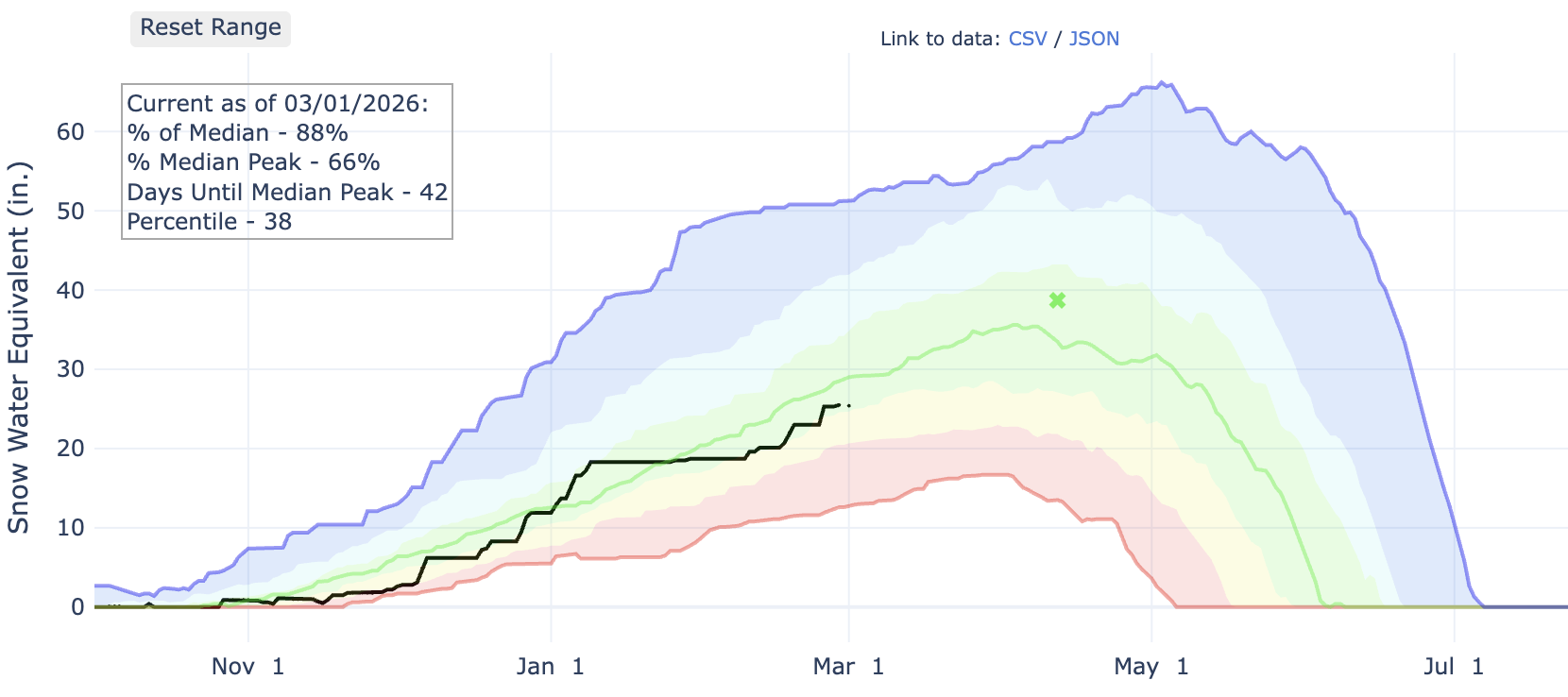
Far southern Utah is seeing similar high-elevation snowpack numbers. Brian Head’s SNOTEL is also doing decently well at 85% of the median.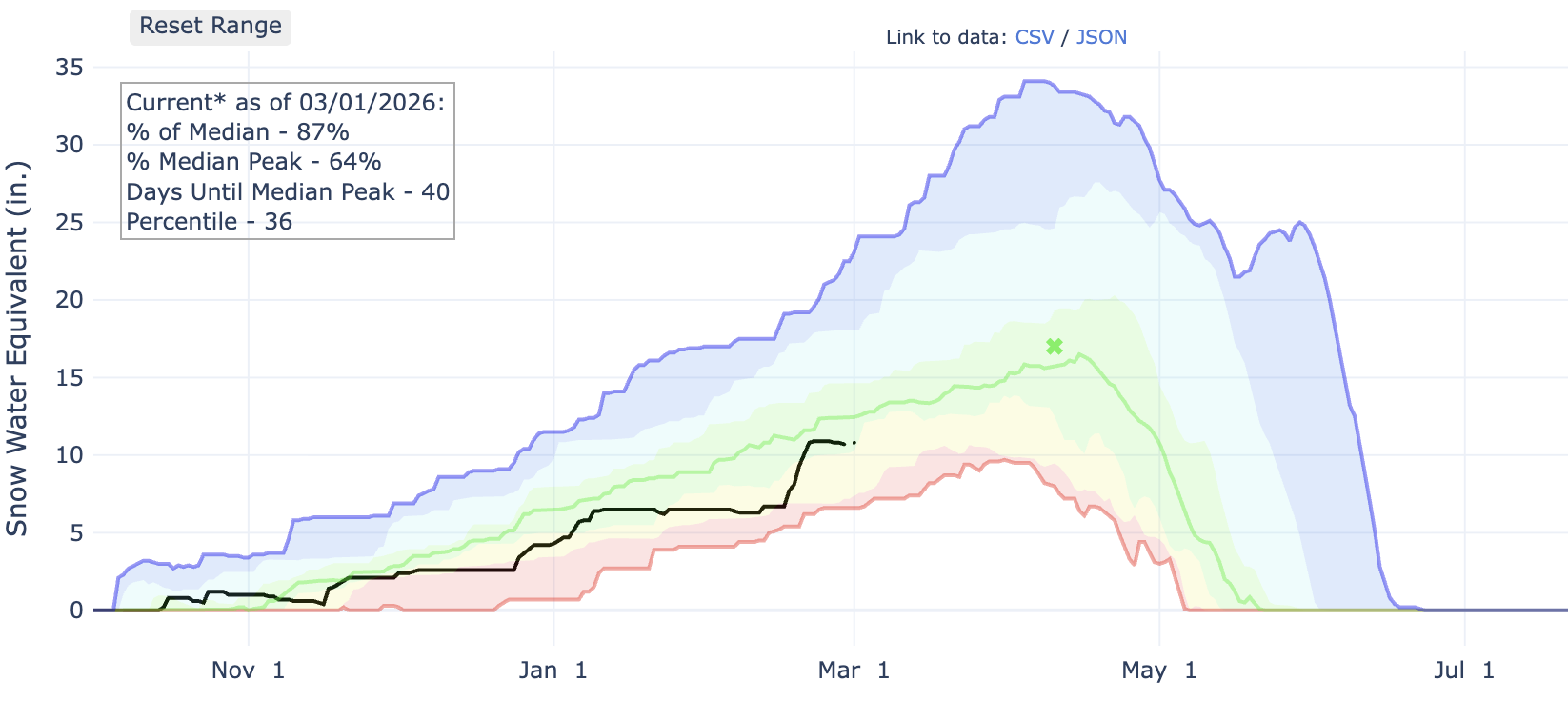
While none of these locations are measuring the type of snowpack we would normally expect in early March, they are not far off from normal. If you have been up skiing lately in these locations, you are probably wondering what all the fuss is about. The mountains are essentially 100% open and have nearly a 100” base depth in many areas. But why are some of these high-elevation sites doing OK, yet Utah’s average snowpack numbers look like this?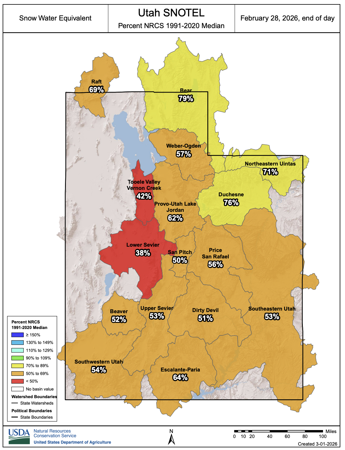
The answer lies not in precipitation, but rather in temperature this year. Our winter season has been so anomalously warm that the average snow level (where rain changes to snow) has been quite literally thousands of feet higher than it normally is on average.
Believe it or not, this has not been a dry season. The total water year (since October 1) precipitation at Snowbird is actually above normal (101%).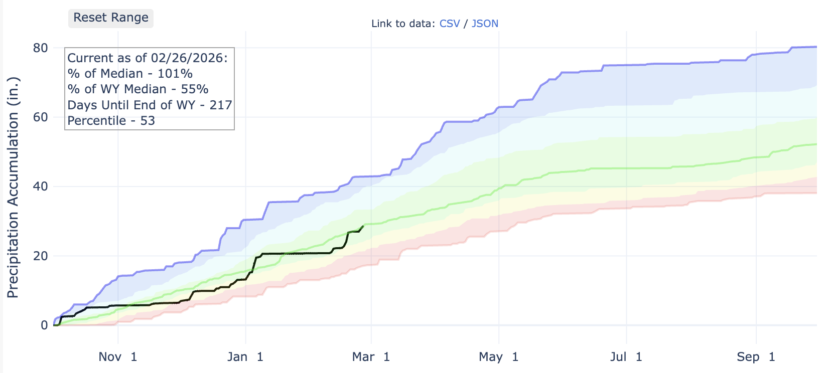
This is not isolated to Snowbird; many sites around both southern and northern Utah have actually seen near-average or above-average precipitation over the past five months.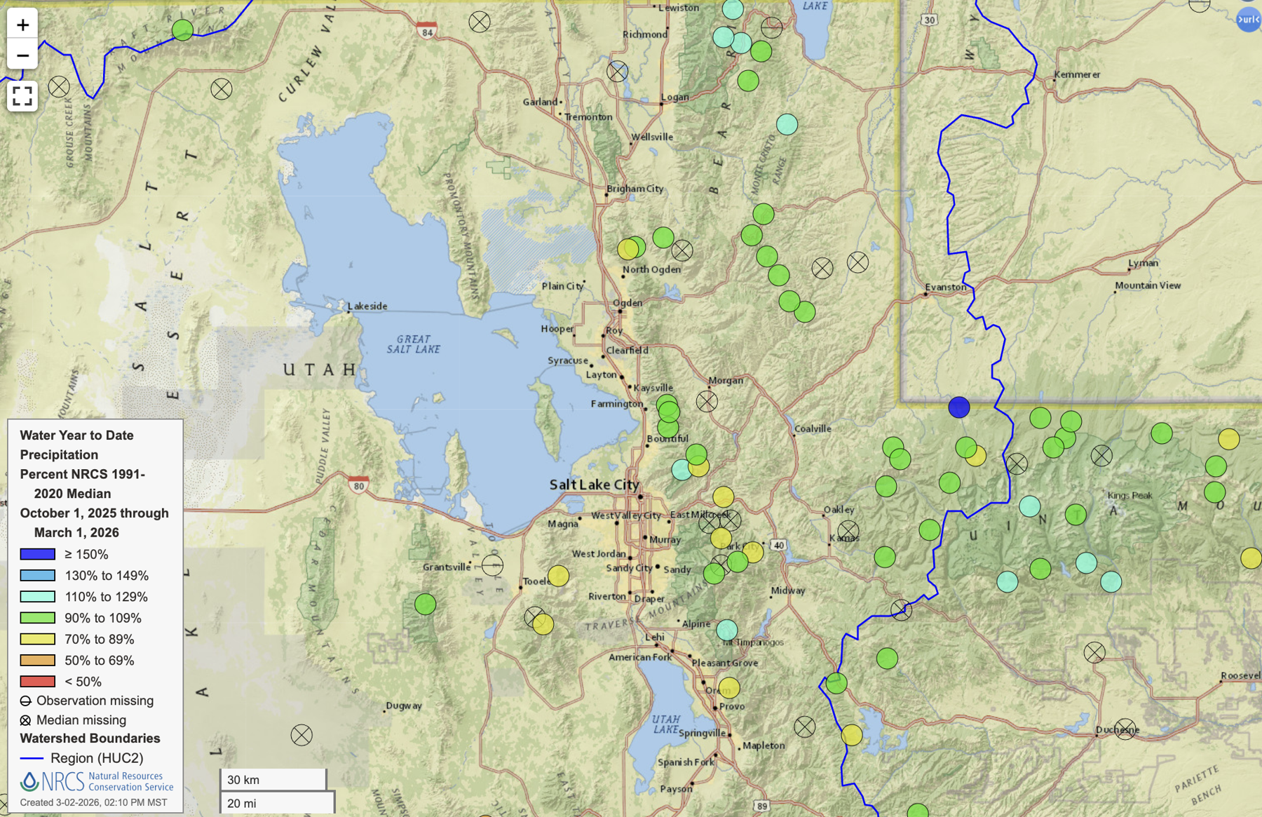
Notice the green dots indicating near-average total precipitation. With blue dots showing locations with above average precipitation. It’s hard to look more “normal” than that for our winter total precipitation.
However, our temperatures this season have been so warm that only the highest elevations have consistently seen snow rather than rain. Even some of those high SNOTEL sites have actually seen rain from time to time this winter.
In Salt Lake City, we wrapped up meteorological winter (Dec-Feb) by exceeding our existing record for the warmest winter season ever recorded. Salt Lake City was more than 7°F warmer than average for the season. This beat our previous record by about 2.5°F.
Because of these warm temperatures, the snow has been limited to the high elevations. The poor middle and low elevation snowpacks bring down the snowpack numbers and we are left with an absolutely atrocious statewide average snowpack.
From the standpoint of skiers, once you can find your way to the highest elevations, the conditions have actually been quite good, all things considered. Sure, we haven’t had the type of quality powder we are used to here in Utah, but because we are still seeing storms, we have had a decent number of dense cream days with a few days of fluffy snow thrown in there for good measure.
The other way to look at this season is to compare how we are doing to other areas of the Western United States.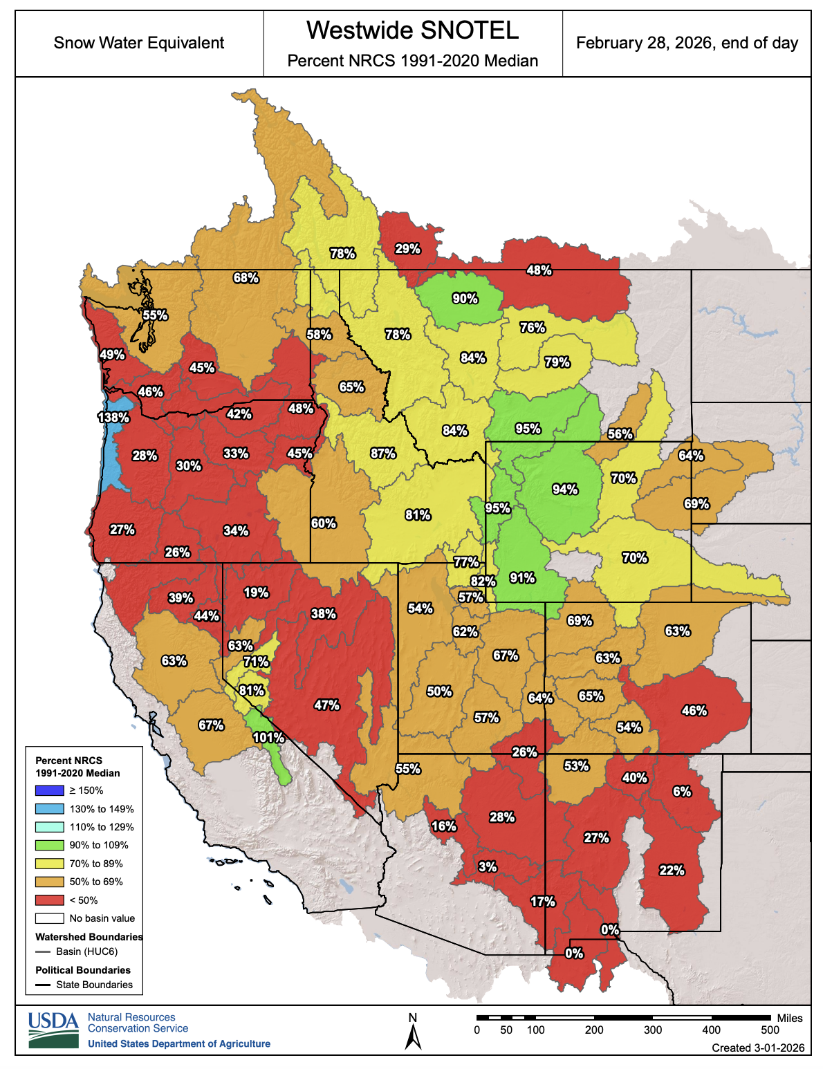
It does not take long to look at this map and realize that while things are certainly not good for Utah, they could be a lot worse. Large swaths of the western states currently have well below 50% of their average snowpack for this time of year. We are blessed to have the elevation and the mountains we have to help generate something, even if it’s not what we are accustomed to.
The nice thing about the Law of Averages is that it works both ways. Barring a March and/or April miracle in our weather patterns, we can probably chalk this season up to be a below-average year in Utah. That just means that we will be due another one of those 600+ inch seasons soon, right?
The Interconnect Tour
Ski up-to 6 resort in 1 day!
Ski Utah Snow Report App
From daily totals and weather to powder alerts and ski day counter.
Last Chair Podcast
Hosted By Tom Kelly
Ski Utah Passport
Available to any 4th, 5th and 6th grade student
The Ski Utah Store
Hoodies, Hats, T-Shirts and More!